Friday Photo #527 – Winter Storm
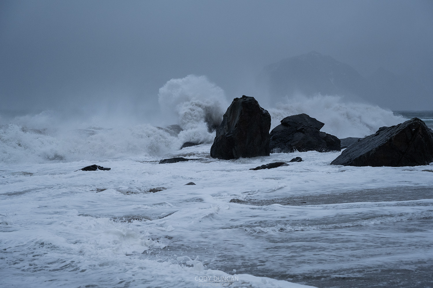
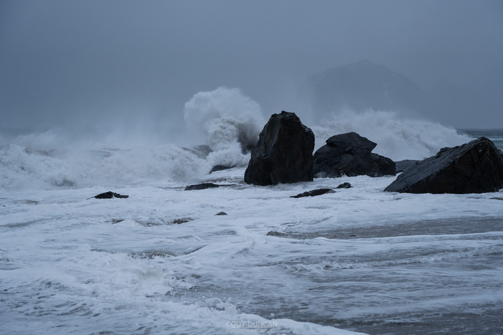
Photo: Crashing waves at Myrland beach during winter storm, Flakstadøy, Lofoten Islands, Norway. February 8, 2023. 12:56
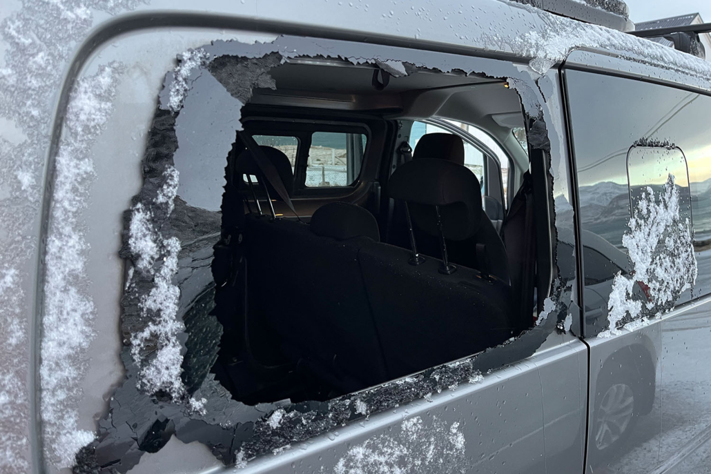
I powerful storm swept over Lofoten on Wednesday causing damage and road closures across the islands. Included in the damage was a smashed rear window on my van – not sure if caused by wind alone or if something hit it. Either way, it was a shock to walk outside Thursday morning, happing that my road had now opened after several days of closure, only to see my van filled with glass and snow. It then took most of the morning and afternoon to come up with a temporary solution until it can get properly fixed in two weeks.
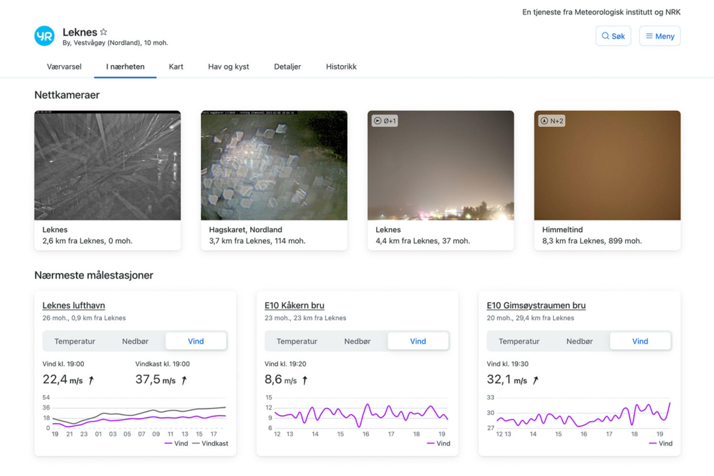
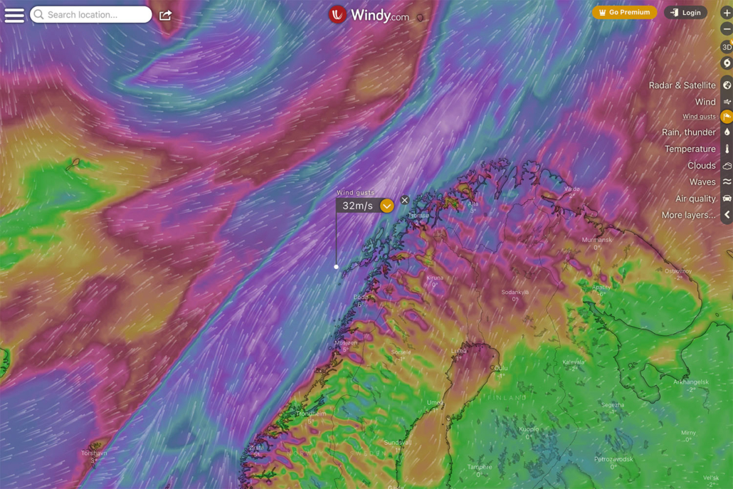
Some of the highest windspeeds recorded Wednesday were 47.3 m/s at Svolvær airport, 39.2 m/s on Skrova, and 37.5 at Leknes airport. Just for reference, hurricane speed winds are anything over 33 m/s. So it was a windy day on Lofoten! But beyond the wind, the warm southern air also brought torrential rain, with one location on Austvågøy measuring 229.6mm of rain in 24 hours.
For Lofoten and safety, this is considered ‘stay at home’ weather. Ferries, flights, and buses were canceled. And the E10 was closed by rock slides and landslides in several location, isolating parts of Lofoten. Also in such windy conditions, lots of pieces of buildings can be blowing around, making it dangerous for both driving and walking. On my drive to Stamsund this morning to fix my window, I could see a lot of debris near the road which had blown from somewhere.
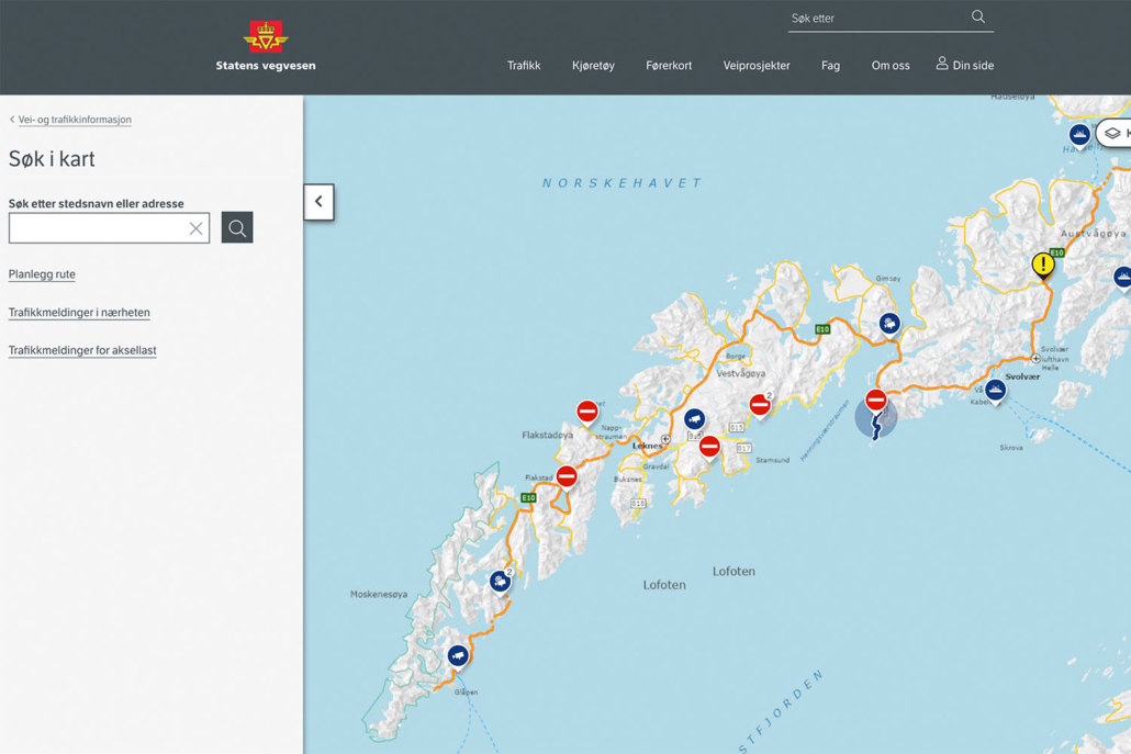
Even if you can’t speak Norwegian, it can be a good idea to checkout the local newspapers (Lofotposten or Lofot-Tidende) and their facebook groups if you see in your weather forecast that a big storm is approaching. These storms are generally forecast and observed for several days before they hit Lofoten, so the local papers will send out warnings and announcements when necessary. Any road closures with be shown on the traffic information map on Statens Vegvesen’s website.
But, as wild as the storm was in reality, without any visual reference, many the ocean for Lofoten, the storms don’t actually look that stormy in photos. I was on the wrong side of the islands to photograph the biggest of the waves, and I would only consider the waves in the above photo as medium: visually somewhat stormy yes, but not too powerful or high. This image is a complete failure to represent to ferocity of the day.
Additionally, when Lofoten receives such weather, the sky is often just grey. Boring flat grey. And in this case, filled with rain. Had I not included a moderately stormy looking beach in the foreground and just photographed some mountains instead, it would look like it was just taken on a boring rainy day.
Head over to my Instagram account for (almost) daily postings of the local conditions here on Lofoten: @distant.north
Camera Info:
Nikon Z7 II
Nikon 24-120mm f/4
60mm
ISO 1000
f 5.0
1/400 second
WB Daylight


Hallo Cody, your photos are the best off, but also very interesting is your text, in particular what you write about the wheather conditions on the Lofoten islands. 230 mm rain in 24 hours- unbelievable and storm with 12 Beaufort.
Thank you for every Friday photo. Best wishes from Sylvia