HORNET HIKING GUIDE
Sørland, Værøy
346 meters
1.6 km
Easy
45 Minutes to Top
Hornet is a highpoint along the central mountain ridge of Værøy. At only 1.6km from the parking lot, it is a short hike on its own and better combined as part of a round trip to Håen or other parts of the ridge. The summit offers 360 degree views over Værøy and the distant Lofoten mainland.
Getting there
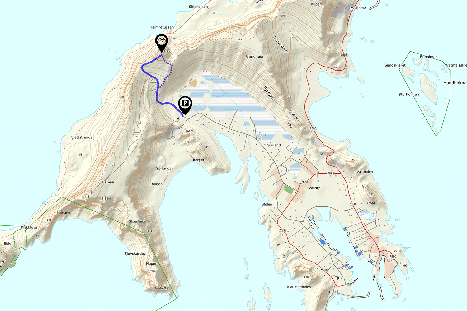
The parking for Håen is located in the top of the valley north of the main village of Sorland.
Park next to the (blue) buildings.
The Trail
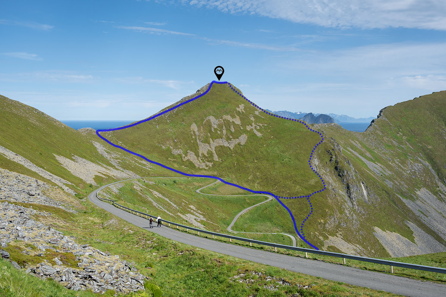
From the parking, follow the sign posted trail on the left side of the building, heading in the direction of the roadway winding its way up the hill. The trail is clear and easy to follow, as it ascends upwards. The trail passes two curves on the road as you ascend and you can choose to join the road at either of them. If you remain on the trail, you will finally briefly join the road on its final 3rd turn.
Briefly walk onto the road before returning to the trail heading straight up the hill ahead of you, towards the center of the low pass on the ridge. Continue up the trail until reaching the ridge. Turn right and follow the well worn trail towards the airy summit, only a short distance away.
If you are returning to the parking lot, it is possible to descend the trail from the right side of the summit. If you are continuing to Håen, return back down the pass, and then either to the road, or continue along the ridge.
Camping
The summit is a bit narrow, though place for a small tent can be found. Otherwise, further back down the mountain has some flatter areas, though a bit rocky in most places.
No water available.


