RYTEN HIKING GUIDE
Fredvang, Moskenesøy
543 meters
3.5 km
Easy
2-3 hours
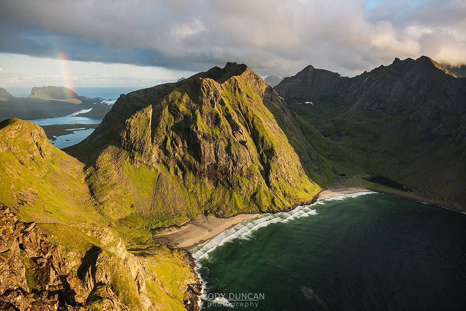
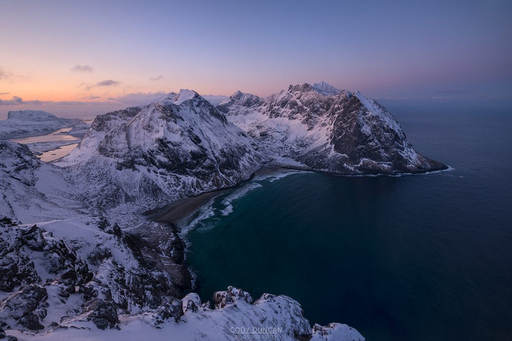
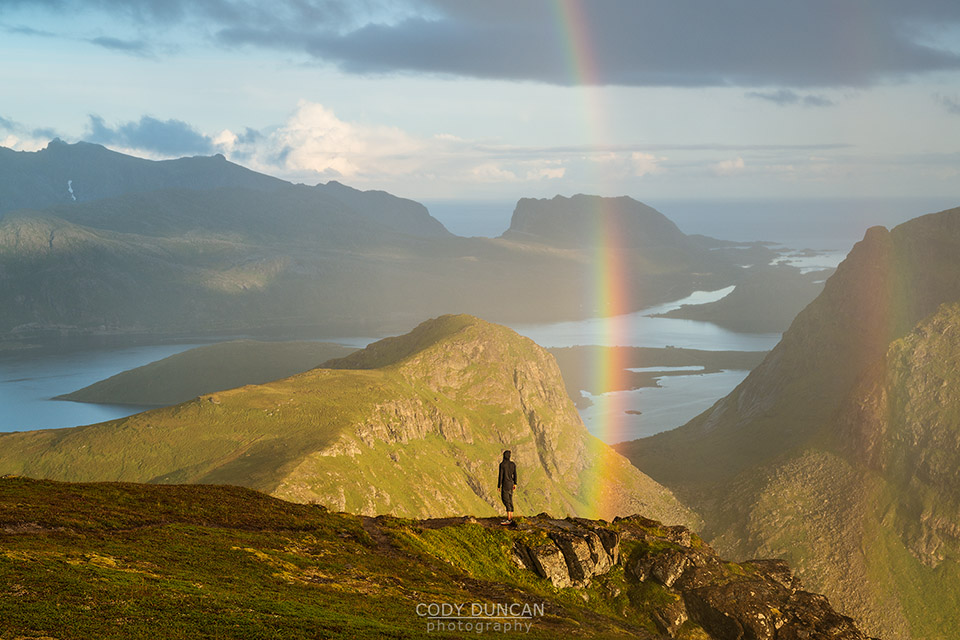
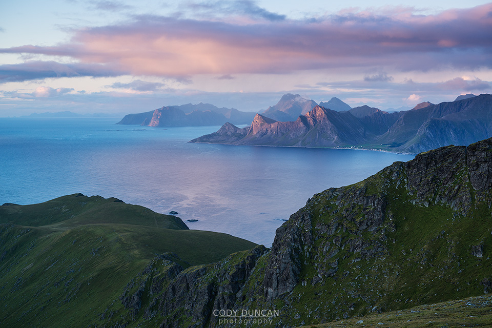
To the north, a late summer sun hangs low over calm waters of the Norwegian sea. Below, Kvalvika beach is illuminated in golden sunlight while a distant rainbow marks the recent passing of a light rain shower. Standing on the beach, Ryten appears as a massive cliff rising to a height of 543 meters directly from the sea. From above, the view back towards Kvalvika beach is one of the most spectacular to be found anywhere on the Lofoten Islands; it is worth making the hike up Ryten for nothing more than this view alone.
Several trails make their way towards the summit of Ryten and a variety of hikes are possible. You can choose from an easy afternoon hike or you may prefer to camp near the summit or Kvalvika beach. Either way, try and wait for a day where you can enjoy the scenic views which this mountain has to offer.
Getting there
I’m going to explain two separate routes up the mountain. The first will be a direct hike passing the Fredvanhytte along the way. The second route will be directions to make the hike via Kvalvika beach. Or it is possible to make a loop out of both routes.
For either route, take the E10 towards the village of Fredvang and cross the two bridges.
Direct Route: After crossing the two bridges, follow the sign posts towards ‘Yttersand.’ You will pass the turnoff towards Fredvang, keep going straight. Follow the road past the ‘Frankenstein’ barn as it turns towards the left. After a few hundred meters, look for sign posted parking area on the left side of the road. Park here.
Via Kvalvika Beach: After crossing the twin bridges, turn left into Fredvang and continue along the road through the village. After approximately 3 km (from the turn) you will see a red boat shed on the left near the water. Immediately past this is a paved parking turnout large enough for 7-8 cars. Park here.
The trail
Direct Route: There is a new sign posted trail starting in the parking area. Follow the trail as it takes you through the meadow and towards the mountain ahead. After crossing the fence, the trail turns right and takes you towards the valley at Innersand where it joins an old farm track before beginning to climb up towards the first pass of the hike.
After making the first climb up to the ridge, the trail turns west, passing two small lakes, before heading up into a rockier area. The trail takes you in the general direction of Fredvanghytte, however you can keep to a path which traverses around the left side of the hill, avoiding a bit of elevation gain to the hut. In a few hundred more meters you’ll see a lake off to the left. Keep to the trail as it heads up the mountain. You’ll find the more spectacular views by taking the ridge route off to the left, but be careful as the cliffs are steep and exposed. A cairn marks the summit.
Via Kvalvika Beach: Directly across from the parking area you will see a trail heading into the bushes and up the hill. There are several entrance points, but they all merge together at some point. The beginning of the trail is moderately boggy as it heads through the mountain birch and up the hill. After 10-15 minutes you will be mostly clear of the trees and head towards the center of the pass. Elevation gain is gentle here as the path takes you between the two mountains.
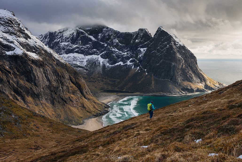
After about 30-40 minutes you will reach the top of the pass and begin the decent to the beach. Here the trail gets steep and rocky in places, and quite slippery if wet. Continue down towards the beach if you can see, or towards the sound of waves if you’re in the clouds. About 1 hour after leaving the car park you should be arriving at the flat, grassy dunes at the back of the beach.
On the right side of the beach you will see a small creek flowing off the hills. Immediately next to it is a trail leading up. Take this. After several hundred meters of climbing, the trail will begin to flatten and you’ll come to a small lake. Pass the lake and try and follow a trail heading towards the left and up the slope of the mountain. You might get off track here, but that is ok. Just keep heading up the mountain until you meet a larger, well worn trail. This trail now takes you back towards the ridge while ascending at a gradual pace. Soon you reach the ridge where the trail follows it up to the summit.
Camping
There are several flat areas on the summit suitable for a tent. No water.
Below the summit, at Forsvatnet lake are also places for a tent, though it can be boggy in places. Water available.
The most popular camping location is Kvalvika beach, with an ascent of Ryten as a side trip. Water available.